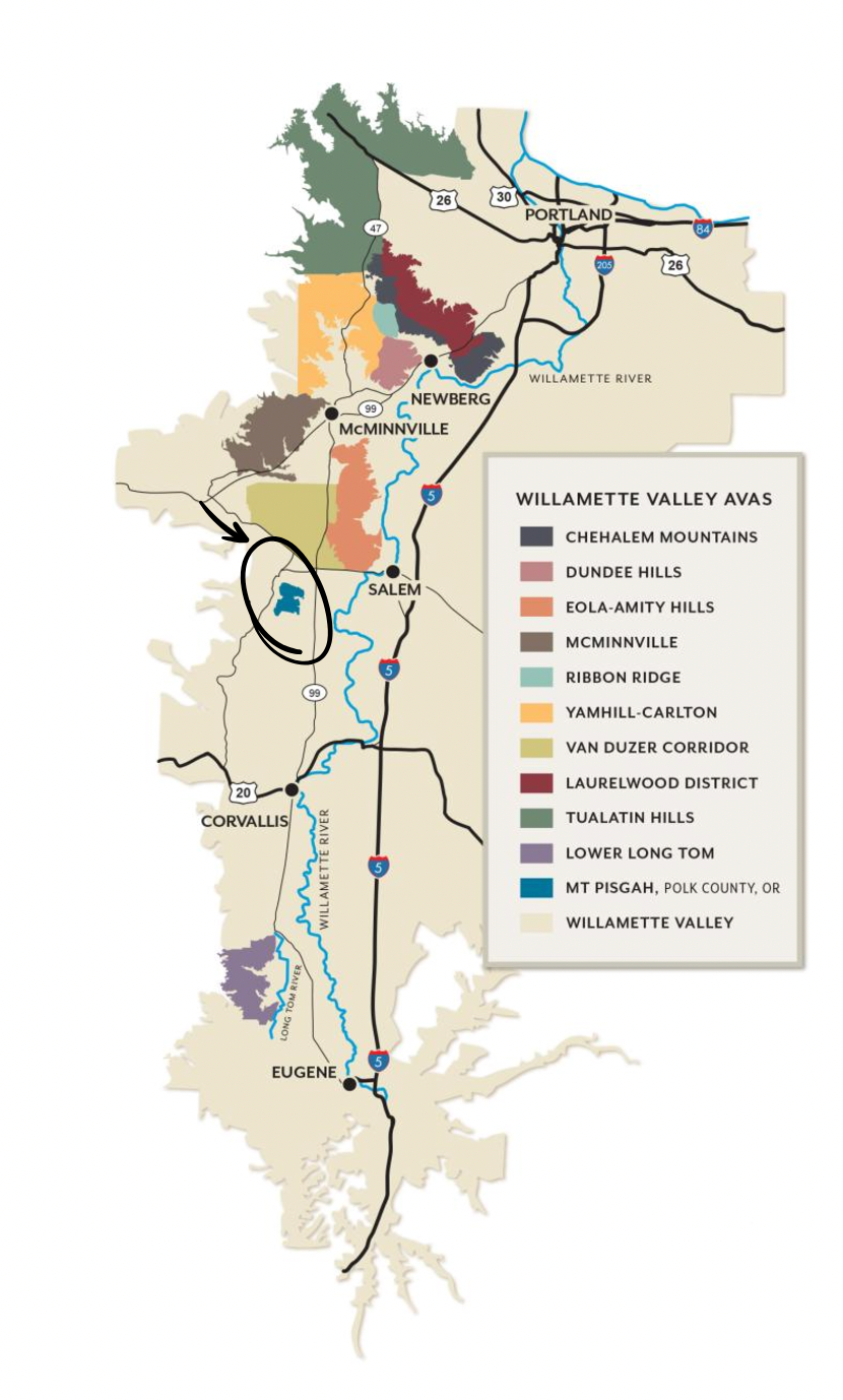
Mount Pisgah, Polk County, Oregon
Mount Pisgah in Polk County Oregon, one of Oregon’s newest and smallest sub-AVA, is situated in the heart of the Willamette Valley, with an excellent combination of grape-growing conditions that produce some of Oregon’s finest grapes. Mount Pisgah was formed 65 million years ago as a sea floor volcano, and has since been covered by marine sediment and pushed up out of the ocean. This unique geology allows the grapes to develop a deep complexity in their shallow soils.
The pioneering work of the Freedom Hill Vineyard enabled 10 other vineyards to spring up in the past 40 years, taking advantage of the warmth near the Willamette, the mild influence of the Van Duzer winds, and the rain shadow of Laurel Mountain to the west. It is the Valley’s second smallest AVA, but one of its most densely planted. Mt. Pisgah, Polk County, Oregon is an idyllic escape from the well-worn paths of Oregon’s wine country.
Mount Pisgah is defined by elevation around the peak. Its lowest point is 260 feet and the top is 835 feet above sea level. Mount Pisgah is only six miles from the Willamette river, making it a generally warm site compared to sites of higher elevation or sites farther from the river.
The planted soils are mostly Willakenzie, Bellpine, and Jory, with some Nekia. The parent material is Siletz Rock, the oldest rock formation in the Willamette Valley. The unique soils and lack of strong winds define the quality of the grapes. Shallow soils promote berry development, the water holding capacity of the clay enables little or no irrigation, and lack of wind reduces transpiration, assisting the systematic health of the vine.
QUICK FACTS
Established: June 3, 2022
Wineries: 2
Tasting Rooms: 3
Brands: 6
Vineyards: 10
Total Area: 5,530 acres
Planted Area: 684 acres
Most common grape varieties: Pinot noir, Pinot gris, Pinot blanc, Chardonnay, Tempranillo
Contact Us


